Florida
Flanked by the Atlantic Ocean and the Gulf of Mexico, crisscrossed by river and streams and dotted with lakes,
Florida is dominated by water. This abundance has not only shaped the landscape but provided
a prefect playground fro citizens and tourists alike.
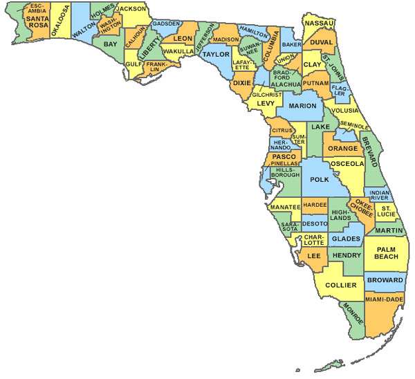
Florida with 14 million population is the southeast corner of United States
just so far south it almost reaches tropics. The Florida peninsula measures about 430 miles north to south,
and the state as a whole covers an area of 58,560sqmiles – roughly size of England.
The state capital is Tallahassee, a comparative small city in the Panhandle – the narrow strip of land extending west along the
shore of the Gulf of Mexico. Florida’s principal international gateways are Miami and Orlando
The Land of Florida
Geologists estimate that Florida is one of the youngest parts of the continental United States
and the last land mass to have emerged from the primordial ocean.
This is a low-lying region, generally less than 100ft above sea level.
The highest point at just 345ft lies in Walton Country. Nowhere in Florida is more than 60miles from the beach.
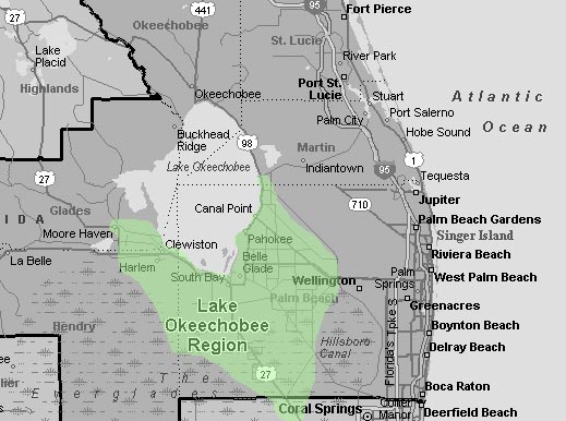
The 450.000acre Lake Okeechobee is the stat’s largest freshwater area. It feeds into the Everglade Basin,
which stretches for many miles with water just a few inches deep. Strictly speaking , this is a really a slow-moving river,
150miles long and 50 miles wide. Now a protected territory, the river – cum- swamp provides a safe haven for about
300 different species of bird,
some 600kinds of fish and a number of animals like the rare Florida panther.
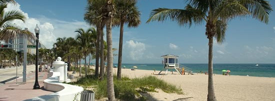
To the north Florida is dominated by great hardwood forests and vast open tracts of beautiful beach.
The Suwannee River flows 177 miles and is fed by more than 20 major springs before reaching the Gulf of Mexico.
Green rolling hills and large pine forest dominate the northwest Panhandle.
This beautiful area, which is edged by salt marshes and expansive sparkling-white sand beaches has been nicknamed the Emerald Coast.
The deep. Lush tropical forests and crystal waters of the Florida Keys remain a haven of peace and quiet and are
perfect for exciting deep-water game fishing, coral 192 miles southwest from the mainland culminating in Loggerhead Key
in the Dry Tortugas, although most people consider Key west to be the end of the line, because that’s the road ends.
Climate of Florida
Florida earns its epithet the Sunshine State whit hot summers, punctuated by tropical storms and often hurricanes.
This area experiences more thunderstorms
than any other part of the USA, the lighting causing numerous fires. Winters are generally warmer than in much of the USA and Europe.
The state can be divided into two climatic zones tropical to the south of line from Bradenton to Vero Beach and subtropical to the
north. Average annual summer temperatures are 26.9C
in the northern, and 55.1 in the southern regions. These fall each winter to about 11.7C in the north and 20.3 in the south.
There are however notable exceptions. Winter tourists are sometimes dismayed at the sight of
first as far south as Miami, thought this phenomenon is rare and usually occurs in
conjunction with blizzards or extremely low temperatures on the northeastern seaboard.
The Keys have never experienced frost. The summer months often bring tropical storms and the state averages 53i of rain a year.
Hurricanes can occur from June to November but are most likely in September
Their movements are constantly monitored and the state has an established evacuation programme.
Hurricanes can hit anywhere along the coast,
through the worst is usually over within 24 hours, with bad weather surrounding the main storm for several afterwards.
|