|
|
Miami - Downtown and Little Havana
When the development of Miami took off with the arrival of the Florida East Coast Railroad in 1896, the early city focused on one square mile (2,5 sq km) on the banks of the
Miami river, site of the present downtown area. Wealthy industrialists from the northern US set up banks and other institutions and built winter estates along Brickell Avenue.
This is now the hub of Miami’s financial district that was spawned by a banking boom in 1980s. Downtown’s futuristic sky-scrapers, bathed nightly in neon, demonstrate the city’s
status as a major financial and trade center.
Even after World War II, Miami was still little more than a resort. It was largely the arrival of Cuban exiles from 1959 onward that turned Miami into a metropolis.
The effect of this Cuban influx is visible most clearly on the streets both Downtown and just across the river in Little Havana. The chatter, faces, shop signs, and food make both
districts feel more like an Hispanic city with an American flavor than the other way around.
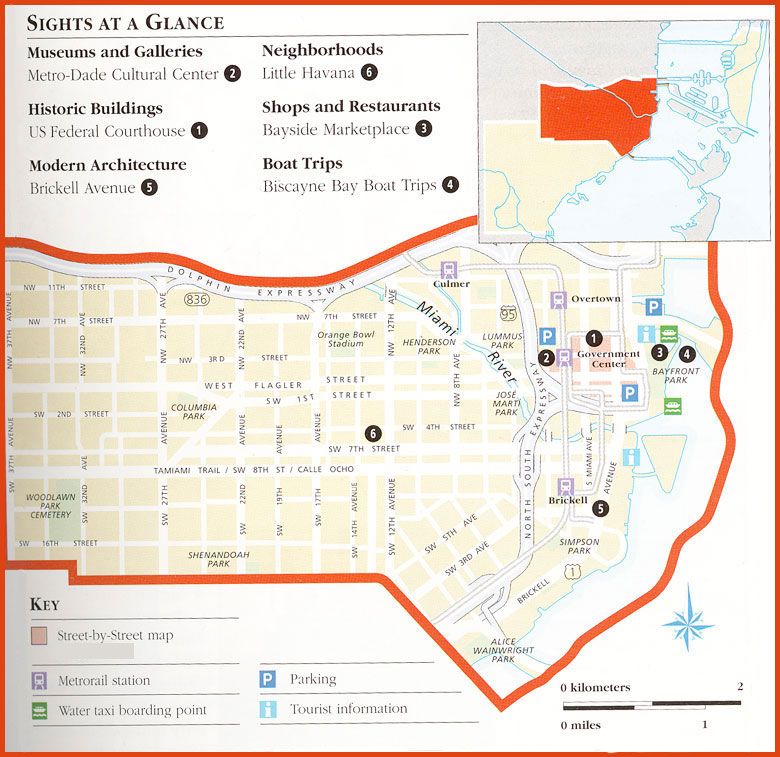
Downtown and Little Havana are enjoyable as much for their atmosphere as for their sights. Downtown has the Metro-Dade-Cultural Center, with one of Florida’s best historical museums,
but tourists are cetered to primarily at the shopping and entertainment mall of Bayside Marketplace, which is also a starting point for relaxing boat trips around Biscayne Bay.
|
|
|